Zone 10 Description
Area: ~1,486 sq km
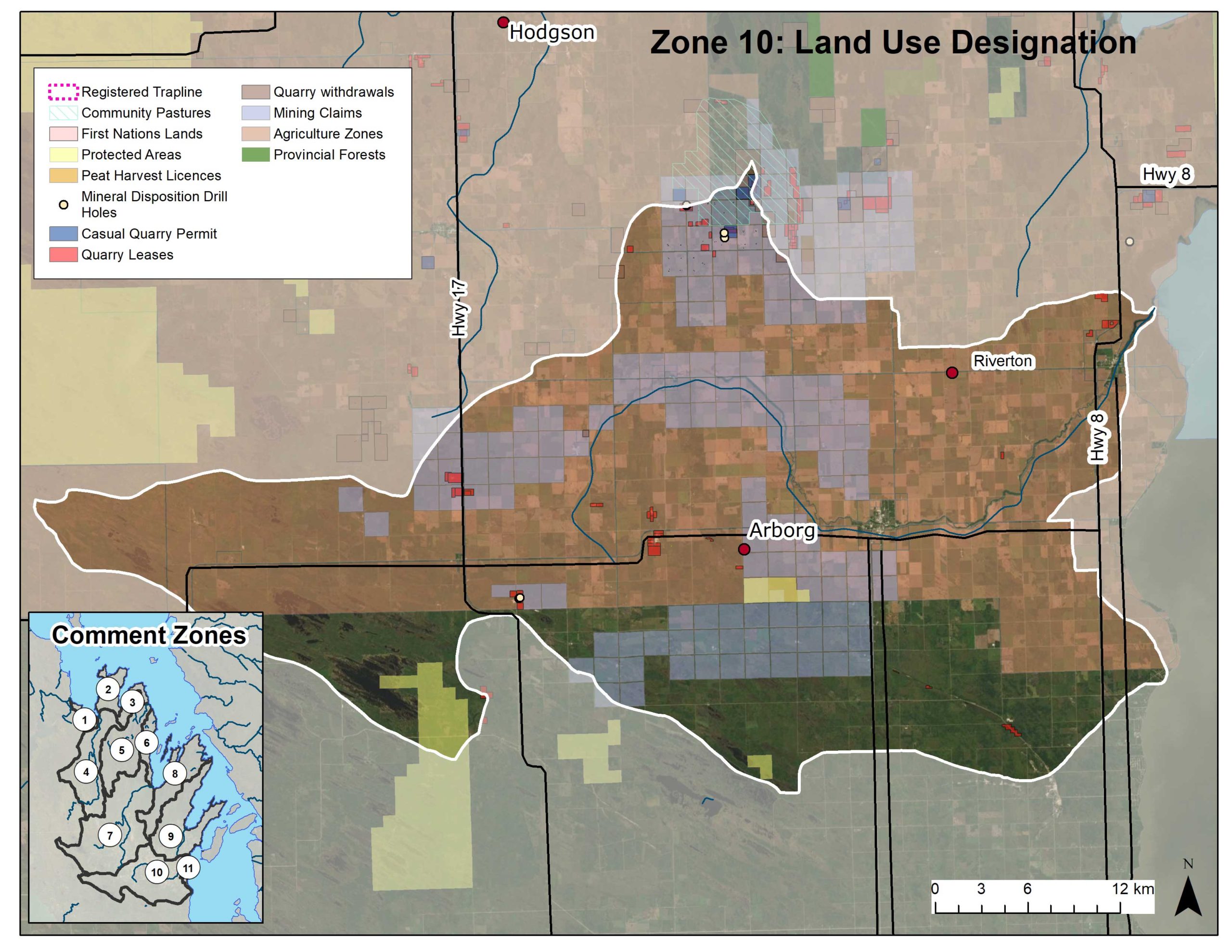
The majority of Zone 10 is an agricultural zone. The communities of Arborg, Riverton, Poplarfield, and Vidir are found in this area, which extends to Arnes in the east, Rembrandt in the south, and nearly to Eriksdale in the east.
The Icelandic River flows through the middle of this area, emptying into Lake Winnipeg just north of Sandy Bar, a popular birding area. The Icelandic River Trail follows the river and connects the town of Arborg to a campground and the Arborg and District Multicultural Heritage Village over a new seasonal walking bridge. It is turned into a skating trail in the winter months.
Snowmobile trails are also prevalent in the area, providing groomed trails connecting Arborg and Riverton to Hecla Island and Black’s Point, then down as far south as Netley Marsh and across Lake Winnipeg to Grand Marais.
There are a number of mining claims, quarry leases, and casual quarry permits in the area.
More Information
Click here to go to the comment zone overview page.
Click here to download the map as a PDF.